Trail Info

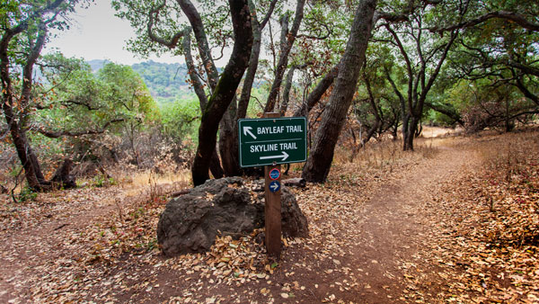
Skyline's trail guide sign
- 1.65 miles horizontal distance.
- Begin at Marie Creek Road (364’ elevation). Gentle rise for 1.13 miles, 6% grade (587’ elevation). Continue to peak for 0.28 miles, 20% grade (844’ elevation). Continue down 0.2 miles, 11% grade. Flat to end at junction with Chaparral Trail.
- Lower Marie CreekHorizontal distance of .31 miles. Begin at point 002, elevation 584 ft. steady rise to Junction, point 004 elevation 800 ft. Average grade 14%.
- 1.31 miles horizontal distance.
- Begin at access road near Disc Golf course (201’ elevation). Drop down (162’ elevation) and then climb to Bikers Bypass, 14% grade (465’ elevation). Continue on the main trail to peak, 24% grade, then down, 20% grade. Continue climbing again, 8% grade, then down again, 10% grade, to flat.
- Bikers Bypass – 0.14 horizontal distance.
- 2.29 miles horizontal distance.
- Begins from Marie Creek Trail near end of Manzanita and the Fig Tree. Steady climb for 1.67 miles, 14% grade, to Sugarloaf Peak (1,630’ elevation). Drop down for 0.65 miles, 20% grade, ending on Skyline Trail.
- 0.61 miles horizontal distance.
- Starts on Lake Marie Road by the Fig Tree. Steep climb to Skyline Trail junction, 10% to 27% grade.
- 0.46 miles horizontal distance.
- Starts from Skyline Trail east of Lake Marie. Trail drops and then rises (893’ elevation). Then rises steeply, 24% grade (951’ elevation). Several rises and drops, 15% to 19% grade. Ends at Marie Creek Trail southwest of Lake Marie.
- 2.27 miles horizontal distance.
- Begins from lower junction with Lake Marie Road, the River to Ridge Trail, and Skyline Trail (208’ elevation). Gradually climb for 0.68 miles, 13% grade (631’ elevation). Continue for 0.98 miles, 7% grade (688’ elevation). Then to trail end at the junction of Skyline Trail (857’ elevation), 45% grade.
- 3.34 miles horizontal distance.
- Begins from lower junction with Lake Marie Road, the River to Ridge Trail, and Buckeye Trail (239’ elevation). Brisk climb on main Skyline Trail, 16% grade (776’ elevation). Numerous ups and downs to the north end of the park (1010’ elevation).
- Lower Skyline trail forks from the main trail at the lower junction. 0.89 miles horizontal distance. Climb is smooth and gradual, 13% grade (781’ elevation). Ends at junction with main Skyline Trail.
- 2.32 miles horizontal distance.
- This is a fire road that begins by the Kiosk through the nine-hole disc golf course and then to the main trail head (138’ elevation). Wide fire road has several technical areas gradually rising to Lake Marie, 7% average grade (819’ elevation).
- 3.4 miles horizontal distance.
- Begins from lower junction with Lake Marie Road, the Skyline Trail, and Buckeye Trail. Numerous ups and downs and technical areas. Ends at Kennedy Park near the Napa River. Return trip elevation gain 387’.